Miami is a sprawling, vibrant city best known for its sunny beaches, diverse culture, and buzzing nightlife. While many associate Miami with driving, the city offers a comprehensive public transportation network that can help you explore its many neighborhoods efficiently and affordably. From trains and buses to free trolleys, here’s everything you need to know about getting around Miami without a car.
The Core Systems: Metrorail, Metromover, and Metrobus
Miami-Dade Transit operates three main services that form the backbone of the city’s public transportation.
1. Metrorail: The Elevated Railway
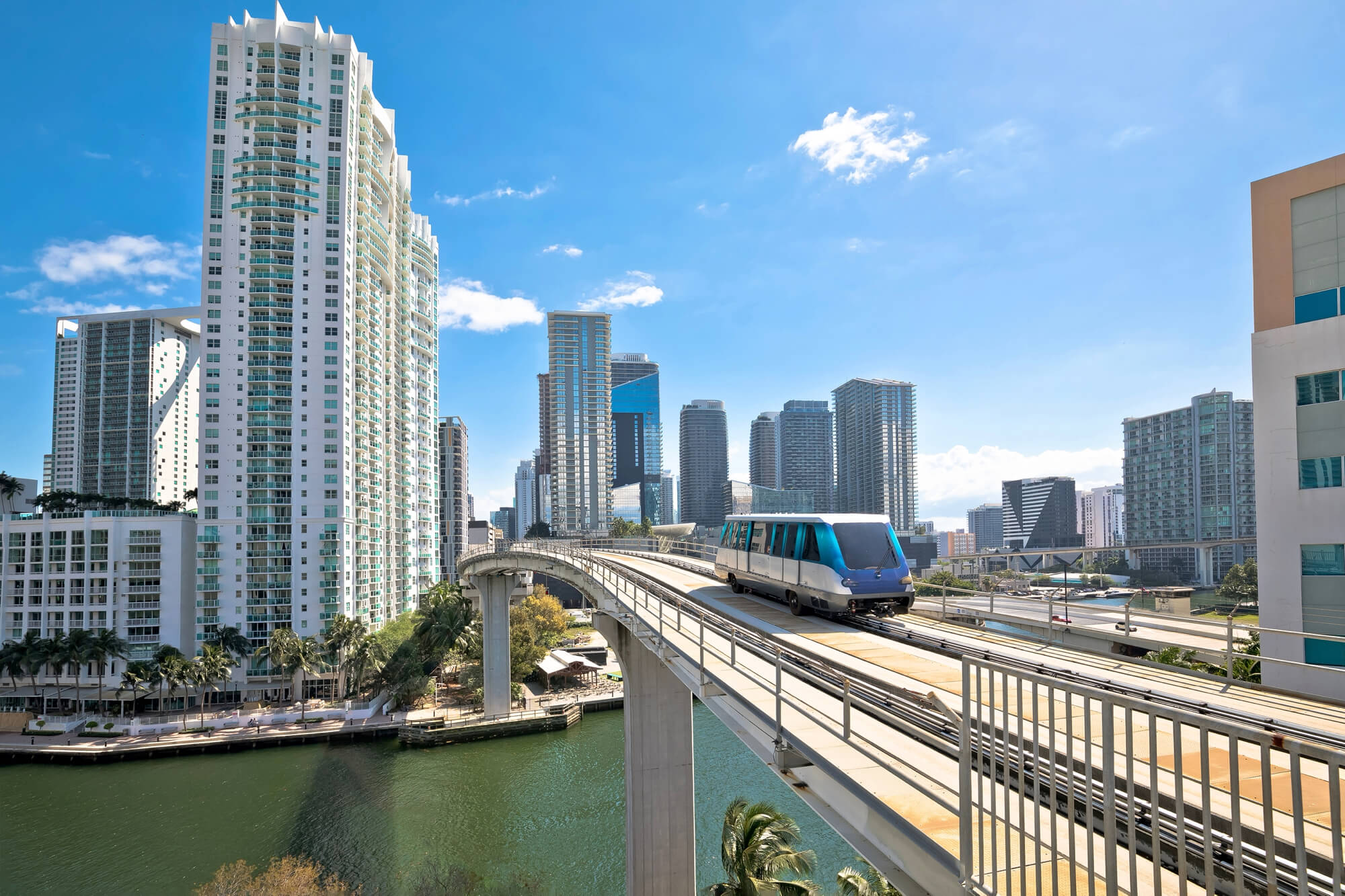
The Metrorail is a 25-mile elevated train system that serves as a fast and reliable way to travel north and south through the county. It consists of two main lines:
- Green Line and Orange Line: Both lines run from Dadeland South up through Downtown Miami. The lines split after the Earlington Heights station, with the Green Line continuing north to Palmetto and the Orange Line branching off to serve Miami International Airport (MIA).
- Key Destinations: The Metrorail is perfect for reaching areas like Brickell (Miami’s financial district), Coconut Grove, the University of Miami, and the Health District. It also provides a direct connection to the airport, making it a great option for travelers.
2. Metromover: The Free Downtown Loop
Perhaps one of the coolest features of Miami’s transit system, the Metromover is a free, fully automated people mover that circles the Downtown and Brickell areas. It’s an ideal way to hop between key locations without walking in the Miami heat. The Metromover operates on three loops:
- Omni Loop: Serves the northern part of downtown, including the Adrienne Arsht Center for the Performing Arts.
- Brickell Loop: Connects to the southern financial district and its many condos, restaurants, and shops.
- Inner Loop: Circles the central business district.
You can easily transfer from the Metrorail to the Metromover at the Government Center and Brickell stations.
3. Metrobus: The Extensive Bus Network
The Metrobus system features more than 95 routes, covering nearly every corner of Miami-Dade County. Buses are the most extensive form of public transit in Miami, reaching areas that the trains do not. Routes are designed to connect with Metrorail and Metromover stations, creating a cohesive network. Some high-frequency routes run along major corridors like Biscayne Boulevard and Flagler Street, offering convenient service throughout the day.
Getting to the Beach: Trolleys and Shuttles
Reaching Miami Beach and South Beach from the mainland is simple with dedicated shuttle and trolley services.
- Miami Beach Trolley: This is a free trolley service that operates throughout Miami Beach on several routes (South Beach Loop, Middle Beach Loop, North Beach Loop, and Collins Express). It’s a fantastic way to get around the island, from the Art Deco Historic District in the south to the quieter shores in the north.
- Route 120 Beach Max: This is a popular and direct Metrobus route that travels from the mainland to Miami Beach. It starts at the Adrienne Arsht Center Metromover station in downtown Miami, crosses the MacArthur Causeway, and runs up the length of Washington Avenue in South Beach.
- City of Miami Trolley: The City of Miami also operates its own free trolley system on the mainland, with routes serving areas like Coral Gables, Wynwood, and Little Havana. You can use these trolleys to connect to Metrorail stations or major bus stops.
Practical Tips for a Smooth Ride
- Get an EASY Card or Ticket: The easiest way to pay for Metrorail and Metrobus is with an EASY Card (a reloadable plastic card) or an EASY Ticket (a disposable paper card). You can purchase and load them at any Metrorail station or online. You can also pay with cash on buses, but you’ll need the exact change.
- Use a Transit App: Download a transit app like the GO Miami-Dade Transit app, Google Maps, or Citymapper. These provide real-time bus and train tracking, route planning, and service updates, which are invaluable for navigating the city.
- Tap and Go: For a quick payment option, you can use contactless payment methods (credit/debit cards or mobile wallets) to tap and pay your fare directly at Metrorail fare gates and on buses.
- Understand the Connections: Miami’s system is designed for transfers. An EASY Card allows for free transfers between Metrorail and Metrobus within a three-hour window. The Metromover is always free and connects seamlessly with both Metrorail and multiple bus routes at key downtown stations.
- Plan for Travel Times: While transit is convenient, Miami is a large city. A Metrorail trip from Dadeland South to the airport can take about 45 minutes. A bus ride from Downtown to the heart of South Beach might take 20-30 minutes, depending on traffic over the causeway.
Using public transportation in Miami is not only cost-effective but also lets you experience the city like a local. It connects you from the urban core of Downtown and Brickell to the iconic sands of South Beach, all while helping you avoid the stresses of traffic and parking.

